
Lodging and Travel
 Join us for the 36th Annual UC Davis Anesthesiology Update, held at the beautiful Silverado Resort in Napa, California, a world renowned destination in the heart of wine country. Nestled among rolling vineyards and framed by majestic oaks and scenic hillsides, the resort offers a relaxing and luxurious setting for both professional enrichment and personal enjoyment. Whether you're unwinding at the spa, golfing on championship courses, or exploring Napa’s renowned wineries, restaurants, and outdoor adventures, there’s something here for everyone. Below, you’ll find detailed directions from nearby airports to help make your travel as seamless as your stay.
Book your room at our special conference rate available here
Directions to Silverado Resort from Nearby Airports
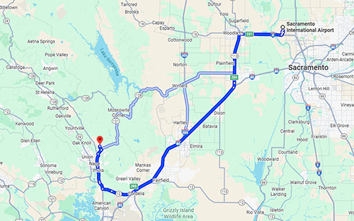
Sacramento International Airport (SMF)
-
Distance: Approximately 65 miles
-
Driving Time: Around 1 hour and 21 minutes
-
Directions: Take Interstate 5 South to Interstate 80 West. Exit onto Highway 12 West toward Vallejo. Continue on Highway 12 and take the exit for Highway 29 South toward Napa. Turn left onto Trancas Street, then right onto Atlas Peak Road. Follow Atlas Peak Road to the resort entrance.
![]() View directions on google maps
View directions on google maps
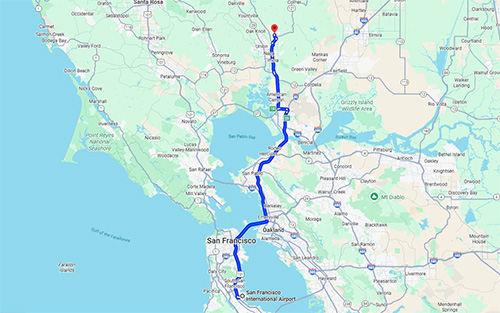
San Francisco International Airport (SFO)
-
Distance: Approximately 61 miles
-
Driving Time: Around 1 hour and 19 minutes
-
Directions: Take Highway 101 North to Interstate 80 East. Exit onto Highway 37 East toward Vallejo/Napa. Continue on Highway 37 and take the exit for Highway 29 North toward Napa. Turn right onto Trancas Street, then left onto Atlas Peak Road. Follow Atlas Peak Road to the resort entrance.
![]() View directions on google maps
View directions on google maps
San José Mineta International Airport (SJC)
-
Distance: Approximately 83 miles
-
Driving Time: Around 1 hour and 38 minutes
-
Directions: Take Highway 880 North toward Oakland. Merge onto Interstate 80 East. Exit onto Highway 37 East toward Vallejo/Napa. Continue on Highway 37 and take the exit for Highway 29 North toward Napa. Turn right onto Trancas Street, then left onto Atlas Peak Road. Follow Atlas Peak Road to the resort entrance.
![]() View directions on google maps
View directions on google maps
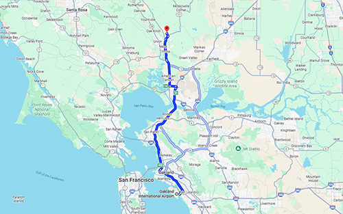
Oakland International Airport (OAK)
-
Distance: Approximately 52 miles
-
Driving Time: Around 1 hour and 10 minutes
-
Directions: Take Interstate 880 North to Interstate 80 East. Exit onto Highway 37 East toward Vallejo/Napa. Continue on Highway 37 and take the exit for Highway 29 North toward Napa. Turn right onto Trancas Street, then left onto Atlas Peak Road. Follow Atlas Peak Road to the resort entrance.
![]() View directions on google maps
View directions on google maps